A winter storm with elevation-dependent impacts is set to move into the North Country and Upper Valley late Wednesday afternoon, lingering until Thursday morning. The storm is expected to cause travel disruptions primarily on Wednesday evening and Thursday morning.
In the broad valleys, precipitation will consist mainly of a rain and snow mix, while areas at higher elevations are likely to see heavy, wet snow.

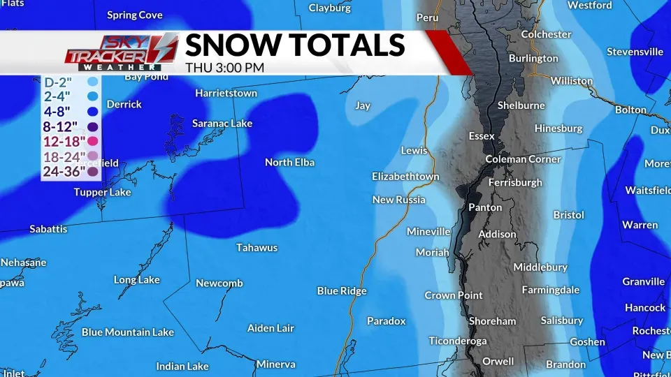
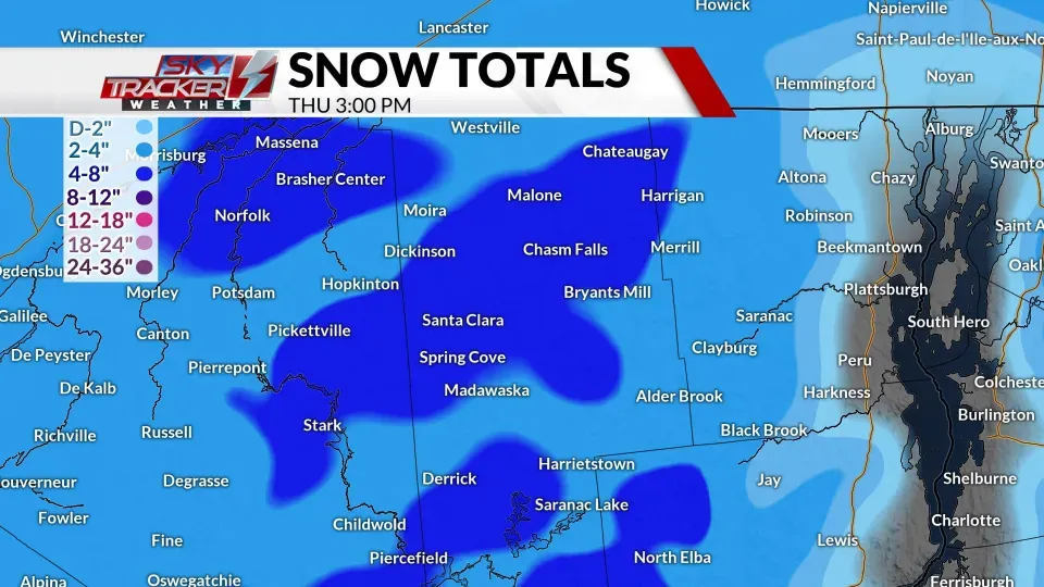
Snowfall projections for northern New York indicate a general accumulation of a dusting to 2 inches in the St. Lawrence River Valley, from Massena to Oswegatchie. In the Adirondacks, totals will range between 4 to 8 inches, with the higher end of the range expected at peaks and summits. Near the Champlain Valley, snowfall will likely taper off to a dusting to 2 inches at most.

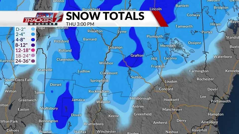
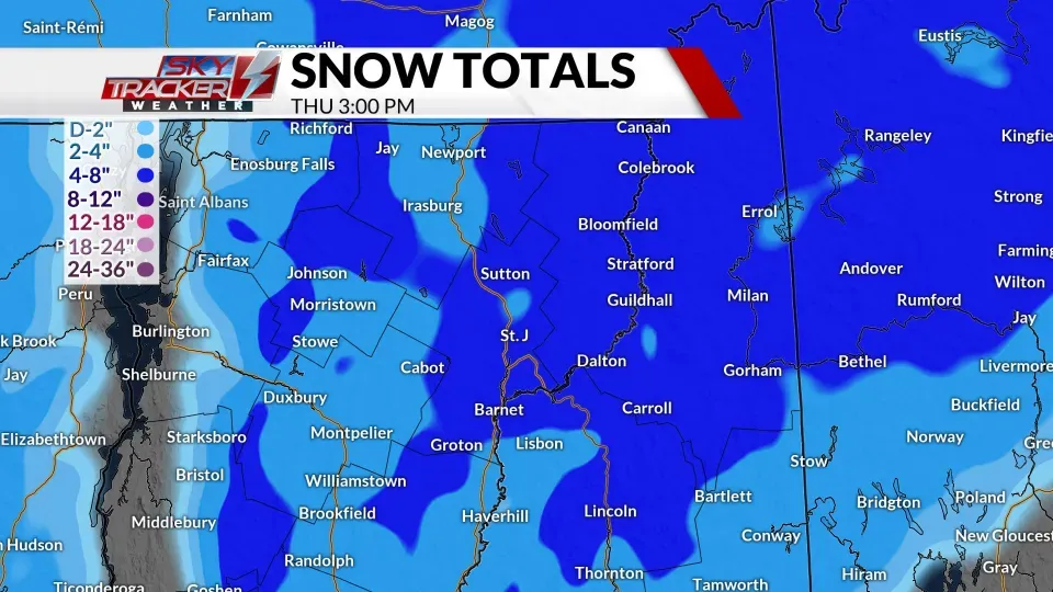
Northern Vermont, central, and northern New Hampshire are forecasted to experience the highest accumulations. East of the Champlain Valley, snowfall is expected to increase rapidly from a dusting to 2 inches to as much as 4 to 8 inches. The Northeast Kingdom, along with Grafton and Coos counties in New Hampshire, is well-positioned to receive these higher totals.

In southern Vermont, rainfall and icy conditions are anticipated to reduce snow accumulations, particularly in the valleys, where totals will remain between a trace and 2 inches. However, higher elevations, particularly along the Route 9 corridor from Bennington through Windham counties, could see accumulations of 2 to 4 inches or more.

The Upper Valley is expected to receive a dusting to 2 inches of wet snow, with mixing likely to limit overall totals in the region.
