Kansas Weather Forecast: From Arctic Chill to Warmer Days Ahead
Kansas finds itself at the edge of retreating Arctic air, signaling a shift from bitter cold to more seasonable conditions. Overnight, temperatures are expected to dip to seasonably chilly levels, but a warming trend is on the horizon as the weekend unfolds.

Weekend Warm-Up
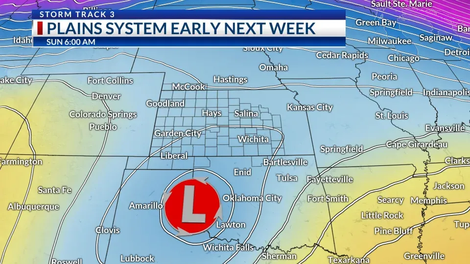
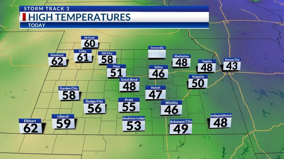
Highs will climb into the 50s across much of Kansas, with areas in the west reaching into the 60s. Meanwhile, active weather to the south will bring rain across Texas, Oklahoma, Louisiana, and Arkansas. This system is expected to push some high-level clouds into southern Kansas over the weekend.

Southeast Kansas may see a few rain showers on Sunday as a system brushes past, steered by an incoming cold front. This front will also usher in cooler conditions, bringing highs back down to the 40s and 50s early next week.
Rockies Energy and Flurry Chances
Behind the cold front, a piece of energy descending south through the Rockies could bring light snow or flurries to western Kansas from Monday into Tuesday. However, drier air will likely limit precipitation for most of the state, especially farther east, where measurable moisture remains elusive.
By Tuesday, colder air will dominate, with highs ranging from the 30s to 40s. A weak disturbance passing overhead on Wednesday may produce a sprinkle or a flurry, but meaningful precipitation remains unlikely.
Looking Ahead

Temperatures will rebound by Thursday and continue warming into the following weekend, with highs in the 40s and 50s under predominantly dry conditions. Forecasters are keeping an eye on potential storm systems that could bring rain or snow between December 15 and 22, with updates to follow as the period approaches.
KSN Storm Track 3 Forecast by Chief Meteorologist Lisa Teachman:
Wichita
- Tonight: Mostly clear. Low: 29°F. Wind: S/SW 5-15 mph
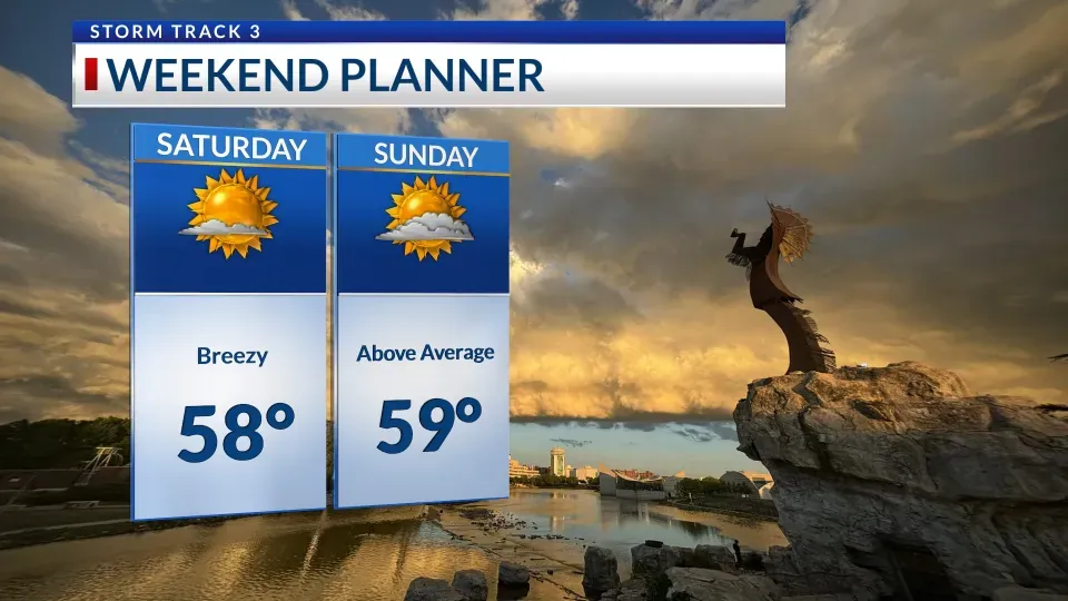
- Tomorrow: Mostly sunny and breezy. High: 58°F. Wind: SW 10-20 mph
- Tomorrow Night: Mostly clear. Low: 39°F. Wind: SW 5-15 mph

Wichita Weekly Forecast
- Sunday: High: 59°F, Low: 37°F. Mostly sunny to partly cloudy, windy.
- Monday: High: 53°F, Low: 28°F. Partly to mostly cloudy, windy.
- Tuesday: High: 44°F, Low: 24°F. Mostly to partly cloudy, windy. 10% chance of rain.
- Wednesday: High: 46°F, Low: 27°F. Partly cloudy. 10% chance of rain or snow.
- Thursday: High: 50°F, Low: 33°F. Partly cloudy.
- Friday: High: 55°F, Low: 35°F. Partly cloudy to mostly sunny, breezy.
Stay tuned for updates as storm systems approach in the lead-up to Christmas!