Beryl is hitting Mexico’s Yucatán Peninsula and will head toward Texas from Sunday night into Monday, posing a hurricane threat. Texas residents should keep an eye on Beryl’s progress.
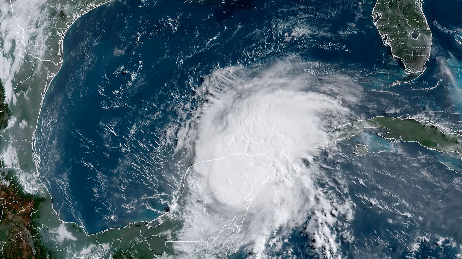
Current status: Beryl is moving across Mexico’s Yucatán Peninsula after making landfall early Friday morning with winds estimated at 110 mph, according to the National Hurricane Center. This was the strongest hurricane the peninsula has seen since Hurricane Delta in October 2020. Beryl is now a tropical storm.
#Beryl Cat. 2 landfall is strongest in Mexico's Yucatán Peninsula since Delta in Oct. 2020.
Surprisingly, not many other Cat. 2+ #hurricanes showed up in the Yucatán in the 2010s. pic.twitter.com/sV1hAsquRQ
— Jonathan Erdman (@wxjerdman) July 5, 2024
Wind gusts reaching up to 81 mph were recorded just south of Playa del Carmen in the heart of Beryl on Friday morning. On Isla Mujeres, just off the coast of Cancún, a gust of 48 mph was reported. Radar data from Mexico’s National Meteorological Service indicates heavy rainfall moving into Mexico from Cozumel northward.
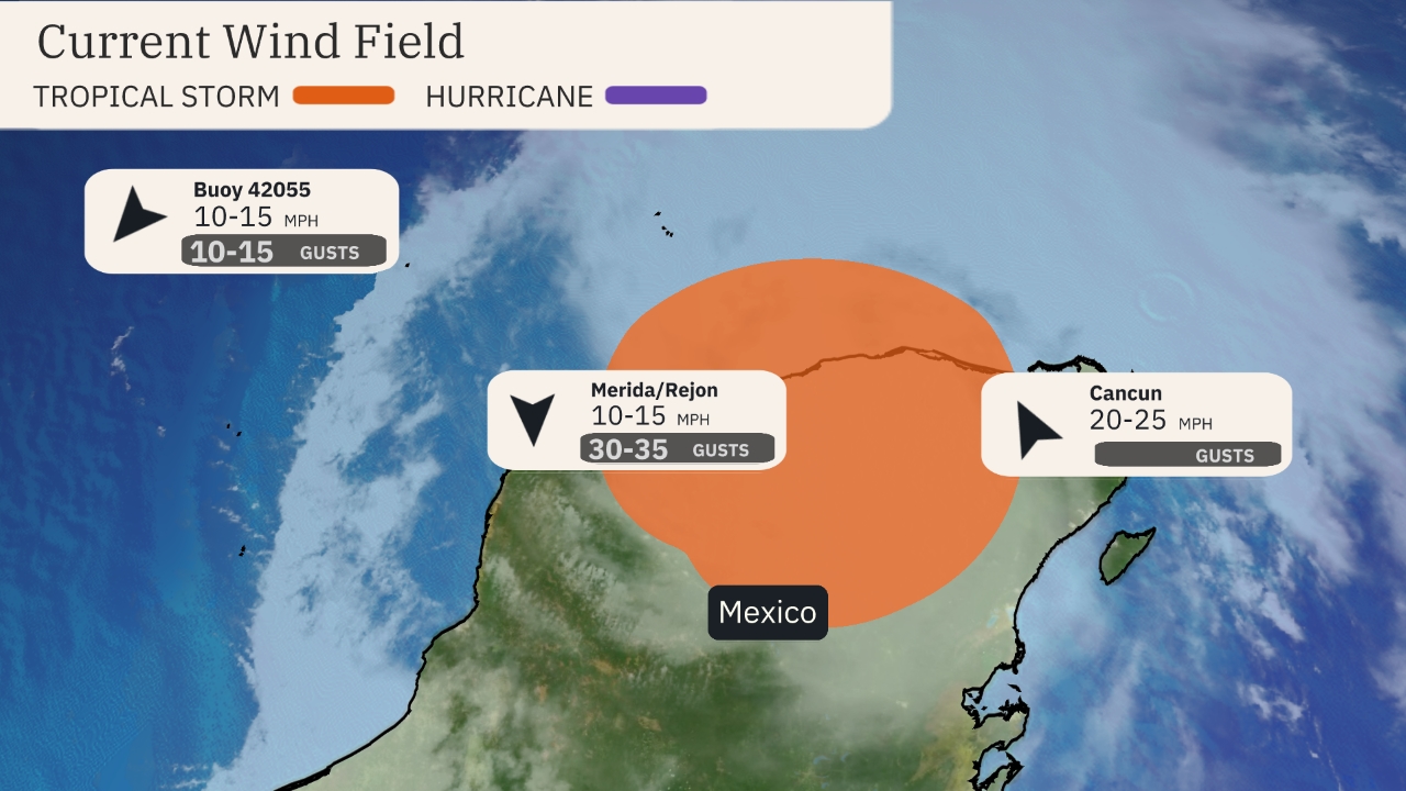
(The orange circle shows the extent of the system’s tropical-storm-force winds (at least 39 mph). The purple circle indicates the extent of hurricane-force winds (at least 74 mph), according to the National Hurricane Center. Current sustained winds at reporting stations are also plotted. )
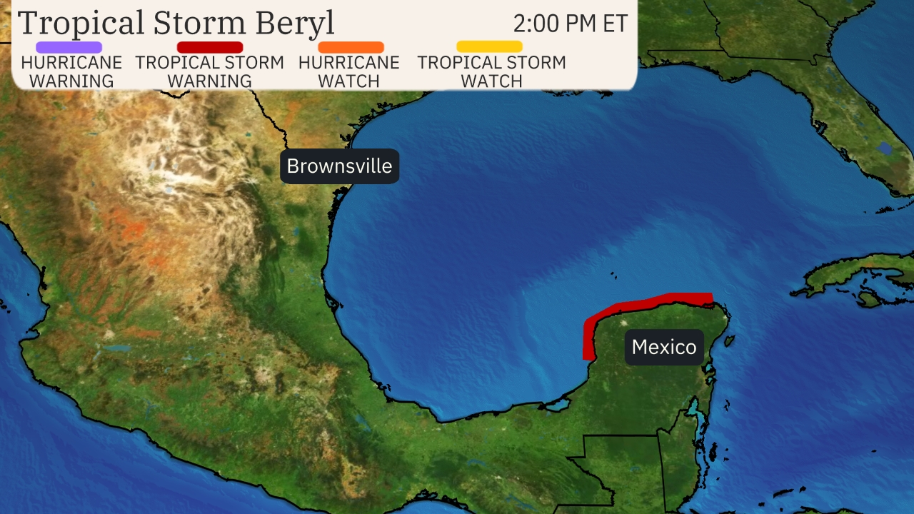
Currently, tropical storm warnings remain in effect for the Yucatán Peninsula.
Later today or tonight, we can expect watches to be issued along parts of the northeast Mexico and Texas coast.
Here’s what to expect from Beryl:
- Friday: Beryl will move across Mexico’s Yucatán Peninsula with damaging winds and up to 10 inches of rain leading to serious flash flooding.
- Friday night: Conditions will improve in the Yucatán Peninsula, however, some lingering winds and bands of locally heavy rain are possible before Beryl moves into the southwest Gulf of Mexico.
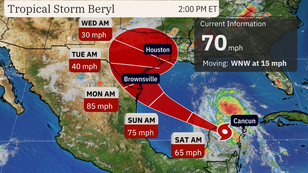
- This weekend: Beryl is expected to be pulled northwestward through the Gulf of Mexico toward the Mexico or Texas coast. Intensification is expected.
- By Late Sunday: preparations along the Texas coast for hurricane conditions should be completed.
The forecast track for Beryl has shifted gradually eastward over the past 12-24 hours. The intensity forecast has also strengthened as Beryl moves towards the northwestern Gulf, increasing the potential threat of a hurricane making landfall.
Potential U.S. impacts: Ahead of Beryl, onshore winds may result in rising surf, rip currents, and coastal flooding along the Gulf Coast from eastern Mexico to Texas starting as early as Friday evening. These conditions could persist until after Beryl makes its final landfall. The rip current risk might extend further east along the northern Gulf Coast as well.
If you have plans for the holiday weekend at beaches along these areas, keep these factors in mind.
Beryl is expected to bring impacts like storm surge and high winds along and north of its track along the Texas coast and northeast Mexico. Similar to Tropical Storm Alberto a couple of weeks ago, which caused significant coastal flooding along the Texas coast.
Additionally, a wide area of heavy rainfall is anticipated near the coast and further inland across northeast Mexico and Texas, potentially leading to flash flooding. This flood threat from rainfall could persist into the middle of next week across parts of Texas and the Southern United States as Beryl’s remnants move northward.